
Engineering surveying and earthwork takeoff
Cut and fill calculations for sites and corridors.
Compare your existing ground with the design and receive cut, fill and net volumes by agreed zone or alignment. Zhou Zhiyong carries out the calculations directly.
We aim to respond within two business days.
When this helps your project
A cut and fill calculation compares the existing ground with a proposed design surface inside an agreed boundary. Volumes may be measured by surfaces, grids or cross-sections, then reconciled by zone and checked for gaps, overlaps, units and revision changes. The result should include quantities, maps or sections, and assumptions such as stripping, bulking or imported material treatment.
- A site or platform needs cut and fill quantities before pricing.
- A road or waterway needs quantities organized along its alignment.
- The project team needs to compare earthwork volumes across zones or drawing issues.
See how the quantities connect to the drawing.
A reviewable comparison of excavation and fill volumes across the agreed site, zones or alignment.
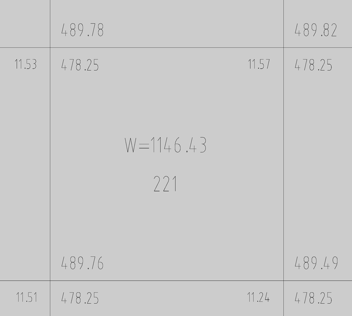
A site calculation grid connects locations and recorded values. The agreed quantity schedule organizes the figures by item or zone; the notes identify inputs and assumptions.
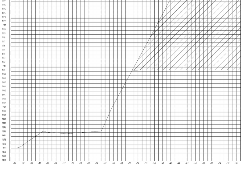
A corridor section places ground and design lines at an identified station. Sections support checking locations along an alignment and the related calculation records.
Start with the information you have.
What to prepare for an earthwork takeoff ↗Available information
- Existing-ground survey, contour or surface data
- Proposed levels, grading plans, profiles or corridor information
- Calculation boundary, zones, material rules, units and drawing revision
Agreed deliverables
- Cut, fill and net volume schedule by agreed zone
- Colour or annotated cut/fill plan for spatial review
- Sections, surface views or grid records appropriate to the method
- Reconciliation, assumptions and revision notes
Scope, quote and delivery
Tell us about the job
Explain what needs measuring. Share a drawing link if you have one; you can enquire before the files are organized.
Agree the scope and quote
We check the available information and agree the deliverables, measurement basis, price and timing.
Receive the agreed files
After calculation and internal checks, you receive the agreed schedules, drawings and notes.
What the service covers
Balance figures depend on the supplied surfaces and declared material assumptions. Haul planning, geotechnical suitability, compaction and bulking factors must be agreed or supplied by the responsible project team.
Questions about this work
Which method will be used for my project?
The method follows the geometry and available source data. Site platforms often suit grid or surface comparison, while road and river work commonly benefits from cross-sections.
Can you account for topsoil or unsuitable material?
Yes when the treatment, depth, limits and measurement rule are defined. They are kept as explicit assumptions or separate quantity items rather than hidden inside a total.
Does net balance equal material available for reuse?
Net geometric volume is the difference between cut and fill. It does not establish material suitability, moisture condition, compaction or bulking. Those project-specific factors must be supplied or reviewed separately.
Tell us about your drawings.
A short description of the job is enough to start. We aim to respond within two business days.