
Grid-method earthwork: assumptions and checks
Use this guide to check what a grid estimate includes and where the source levels need closer attention. It cannot select a grid spacing or approve a quantity without the project survey, design and measurement rules.
Content basis: Original Chinese method explanation by Zhou Zhiyong, relayed by his son. Zhou Civil Works prepared this article from that explanation and the published drawing, with AI assistance for English adaptation, editing and reference lookup.
What the calculation represents
A square grid places survey and design levels at matching plan positions within the agreed calculation boundary. Both sets of levels must use the same datum and units. The following is a four-corner approximation for a complete square cell; the source handbook also discusses cases that need different treatment.
V = A × (h1 + h2 + h3 + h4) ÷ 4A is the horizontal area of a complete square cell in m². Each h is existing level minus design level at one corner, in m; positive means cut and negative means fill. V is the signed geometric estimate in m³. Use this simple form where one cut/fill condition represents the cell. For an all-fill cell, report the magnitude as fill. Four corner readings approximate the interior surface; a mixed cell needs separate cut/fill treatment, not a net total relabelled as both quantities.
Sum cut quantities and fill magnitudes separately, including the separately assessed regions of mixed cells. Keep any net balance as a distinct result. Before relying on a total, identify the drawing revision, units, calculation boundary and treatment of partial cells.
Find a cell in the published drawing
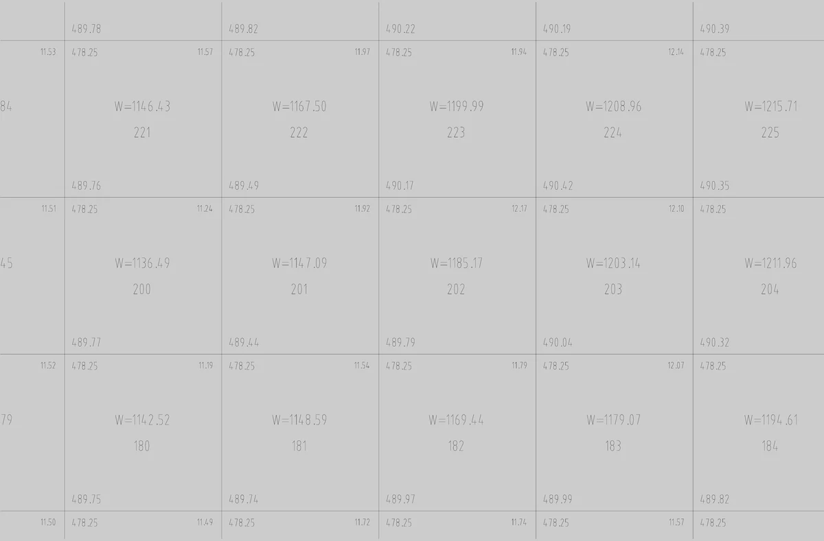
Find cell 221 beneath the W label near the top left of the crop. Numbers sit around its four intersections. This identifies a cell to trace in the full drawing and quantity schedule. The crop does not show the level legend, cell dimensions or unit note, so it cannot establish which number is a design level or support a fresh volume calculation.
Checks at edges and changes in level
The handbook calls for additional observations where ridges or swales fall between grid corners, and for depths at the outside boundary. Apply that check to the survey before choosing spacing. A finer calculation grid cannot recover a ditch or ridge absent from the source data. At a sloping boundary, document the actual partial-cell geometry; at a cut/fill transition, locate and treat the separate regions.
- Confirm that the calculation boundary matches the scope being measured.
- Check that existing and design levels are identified consistently at each point.
- Review partial cells and break lines instead of assuming every cell is a complete square.
- Compare the schedule with the drawing revision and stated units.
How to document a reviewable result
A useful grid deliverable keeps the calculation drawing, quantity schedule and assumptions together. The grid can be a practical checking aid when the reviewer can trace a cell back to its four levels and understand how edge conditions were treated.
No single method removes the need to check source data, boundaries and project-specific measurement rules. If those inputs change, the affected cells and the reported total should be revisited.
Sources and notes
- Grid-method worked sample. The published crop shows numbered cells, W labels and numbers around grid intersections. Its legend, grid dimensions and unit note are outside this crop.
- USDA handbook: land leveling and the four-point method. The archived land-leveling handbook gives a four-point approximation and discusses boundary points and additional observations at ridges and swales. For an all-cut square, its formula reduces to area times mean corner depth when expressed in consistent length and volume units. The formula below uses metres throughout. This is a method reference, not a project measurement specification. National Engineering Handbook, Section 15: Irrigation, Chapter 12: Land Leveling. [Publisher: USDA Soil Conservation Service, archived by USDA NRCS; Version: Archived SCS edition; publication date not stated in the linked scan; Section: Chapter 12, Surveys p. 12-5; Earthwork Calculations pp. 12-29 to 12-32]
2026-09-11: Added handbook references, clarified the formula assumptions and separated drawing observations from calculation checks.
For corrections, email the article and the relevant drawing location: hello@zhoucivil.com