
Engineering surveying and earthwork takeoff
Earthwork takeoffs for tenders and project reviews.
Turn your drawings into itemized earthwork quantities for a tender, quantity check or revised design. Zhou Zhiyong carries out the calculations directly.
We aim to respond within two business days.
When this helps your project
An earthwork quantity takeoff measures excavation, fill, grading, pits, trenches or related work from an agreed set of plans and survey information. The service confirms the scope and measurement basis first, calculates the required quantities, and returns schedules, marked drawings and calculation notes so an estimator or project engineer can review how each figure was derived.
- You have issued drawings and need quantities for tender pricing.
- A quantity check is needed before the project team finalizes its estimate.
- Drawings have changed or your team needs additional calculation capacity.
Drawing changes and additional capacity
Send the revised drawings with the baseline revision and identify the changed scope where possible. We compare the inputs, confirm the affected calculations, and agree any additional work and timing. Production support can also cover a defined part of your team’s takeoff package.
See how the quantities connect to the drawing.
An agreed quantity package with its drawing basis, units, boundaries and assumptions stated clearly.
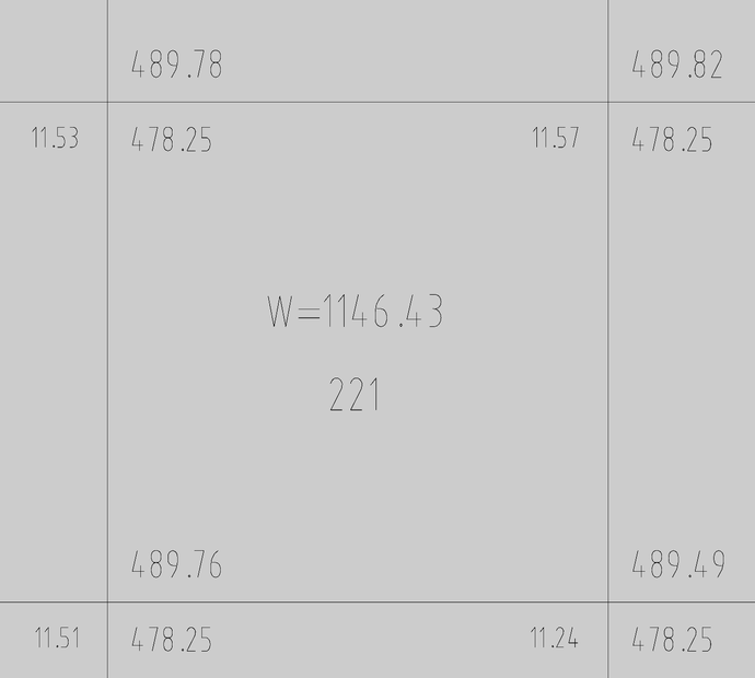
A site calculation grid connects locations and recorded values. The agreed quantity schedule organizes the figures by item or zone; the notes identify inputs and assumptions.
Start with the information you have.
What to prepare for an earthwork takeoff ↗Available information
- Issued PDF or CAD plans with drawing revision
- Survey points, contours or an existing-ground surface when available
- Scope boundary, measurement rules, required units and deadline
Agreed deliverables
- Itemized quantity schedule in XLSX or agreed tabular format
- Marked PDF or CAD drawing showing measured limits
- Calculation sheets with units, assumptions and revision notes
- Cross-sections or grid records when required by the method
Scope, quote and delivery
Tell us about the job
Explain what needs measuring. Share a drawing link if you have one; you can enquire before the files are organized.
Agree the scope and quote
We check the available information and agree the deliverables, measurement basis, price and timing.
Receive the agreed files
After calculation and internal checks, you receive the agreed schedules, drawings and notes.
What the service covers
This service supplies calculations and supporting documents. Your responsible project team confirms commercial rates, local measurement rules and the final submission, and retains responsibility for design review and approvals.
Questions about this work
What file formats can I send?
PDF and DWG are the usual starting points. Survey points, contours, LandXML or other surface data are useful when available. The scope review confirms what can be used before quotation.
Can the quantities be revised when drawings change?
Yes. We compare the new issue with the baseline revision and confirm the affected calculations, additional work and delivery arrangement before proceeding.
Are the outputs suitable for tender review?
They can support estimating and tender review when the supplied design information is adequate. The project team remains responsible for its commercial rates, local rules and final submission.
Tell us about your drawings.
A short description of the job is enough to start. We aim to respond within two business days.