
Cross-section earthwork: spacing and checks
A section area is only one input to a reach volume. This guide explains that distinction and the spacing checks to discuss with the reviewer; a single section cannot establish the quantity for a corridor.
Content basis: Original Chinese method explanation by Zhou Zhiyong, relayed by his son. Zhou Civil Works prepared this article from that explanation and the published drawing, with AI assistance for English adaptation, editing and reference lookup.
What the calculation represents
At each station, measure the regions between the existing-ground and design lines as separate cut and fill areas. An area in m² describes that section. A volume in m³ also needs the adjacent section and the distance between them.
V = (A1 + A2) ÷ 2 × LA1 and A2 are nonnegative cut areas at the two end sections, in m²; L is their separation in m and V is the estimated cut volume in m³. Repeat separately with nonnegative fill areas for fill volume. This is the trapezoidal approximation to area change between sections. On a straight reach, use consistently oriented sections perpendicular to the alignment. Curves require the project’s distance and section rules; a signed net area cannot replace separate cut and fill areas.
The reach quantities are then added along the alignment. The method is easy to inspect when station numbers, section drawings and the quantity schedule use the same reference system.
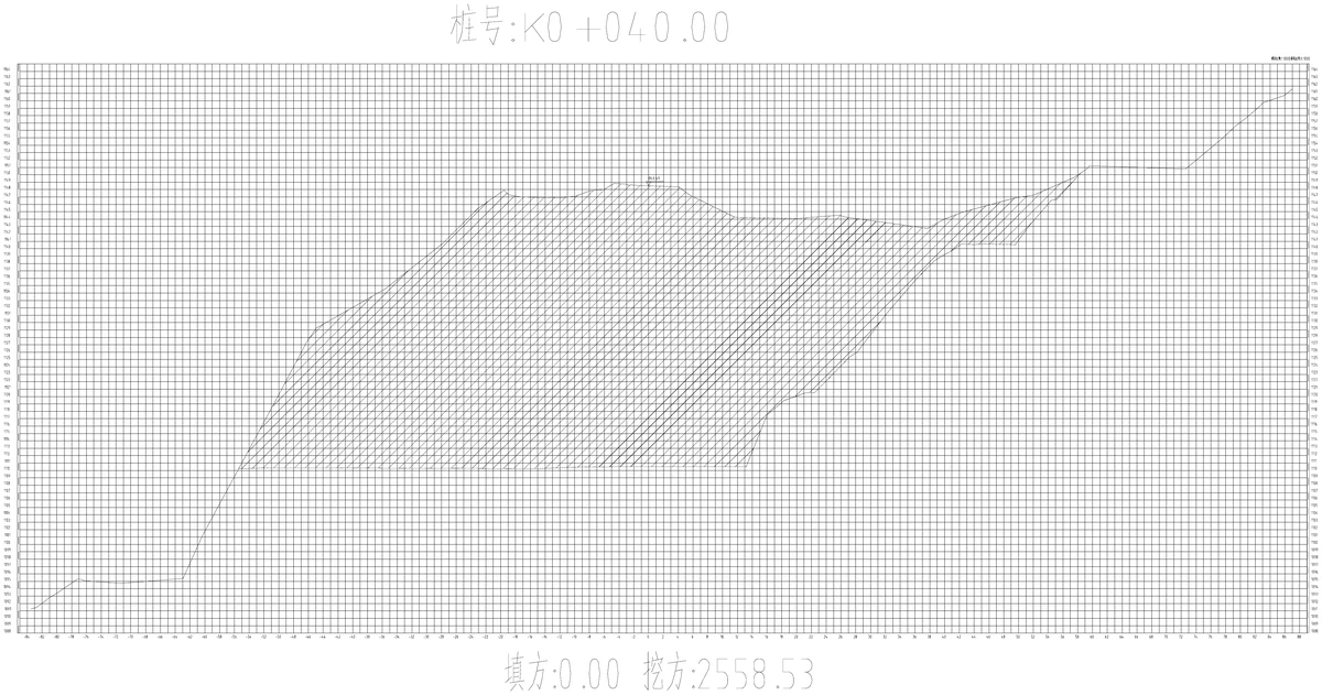
What K0+040.00 shows
The station label is at the top of the published section. The hatched region lies between two profiles, and the bottom labels identify fill (填方) and cut (挖方). The crop does not provide a readable unit note or the adjacent station. Check those in the full drawing before using the displayed quantity as a section area; this image alone cannot prove a reach volume.
Checks between stations
The average-end-area estimate represents the change between two measured sections. If the ground or design changes materially between stations, the review should consider whether an intermediate station or a different modelling approach is appropriate.
- Check that stations are located and labelled against the current alignment.
- Confirm that sections are oriented consistently, including on horizontal curves.
- Look for intermediate ditches, mounds, transitions or profile changes that are not represented by the two end sections.
- Reconcile section areas, spacing and units with the quantity schedule.
How to document a reviewable result
A reviewable corridor package links each quantity reach to its station pair and section drawings. Where spacing has been changed, the reason and the affected stations should be visible in the calculation notes.
Station densification can provide more observations where the source information shows a transition or irregular feature. It is a project decision, not a universal correction, and remains dependent on the survey, design and agreed measurement basis.
Sources and notes
- Cross-section worked sample. The published section identifies K0+040.00 and shows a hatched region with cut and fill labels. The crop alone does not document the adjoining section or a reach volume.
- USDA handbook: the end-area method. The handbook calculates cut and fill separately from adjacent end areas. Its denominator 54 includes the average of two areas and the cubic-feet-to-cubic-yards conversion. With metres and square metres, the equivalent denominator is 2. The reference concerns land leveling; applying it to a corridor also requires the alignment and section geometry. National Engineering Handbook, Section 15: Irrigation, Chapter 12: Land Leveling. [Publisher: USDA Soil Conservation Service, archived by USDA NRCS; Version: Archived SCS edition; publication date not stated in the linked scan; Section: Chapter 12, Earthwork Calculations, The end-area method, pp. 12-32 to 12-33]
2026-09-11: Added handbook references, clarified the formula assumptions and separated drawing observations from calculation checks.
For corrections, email the article and the relevant drawing location: hello@zhoucivil.com